Celeste River
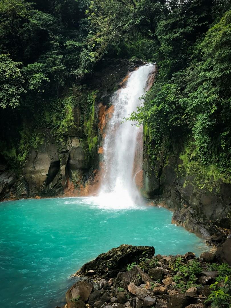
Hidden in the northern region of Costa Rica, the Celeste River (Río Celeste) winds through Tenorio Volcano National Park with a color so vivid it seems unreal. The river’s striking turquoise hue is caused by a natural chemical reaction between two mineral-rich streams, Quebrada Agria and Río Buena Vista, which merge at a point known as "El Teñidero." This one-of-a-kind phenomenon creates the illusion that the water has been dyed blue, even though no pigments are present.
Erawan National Park
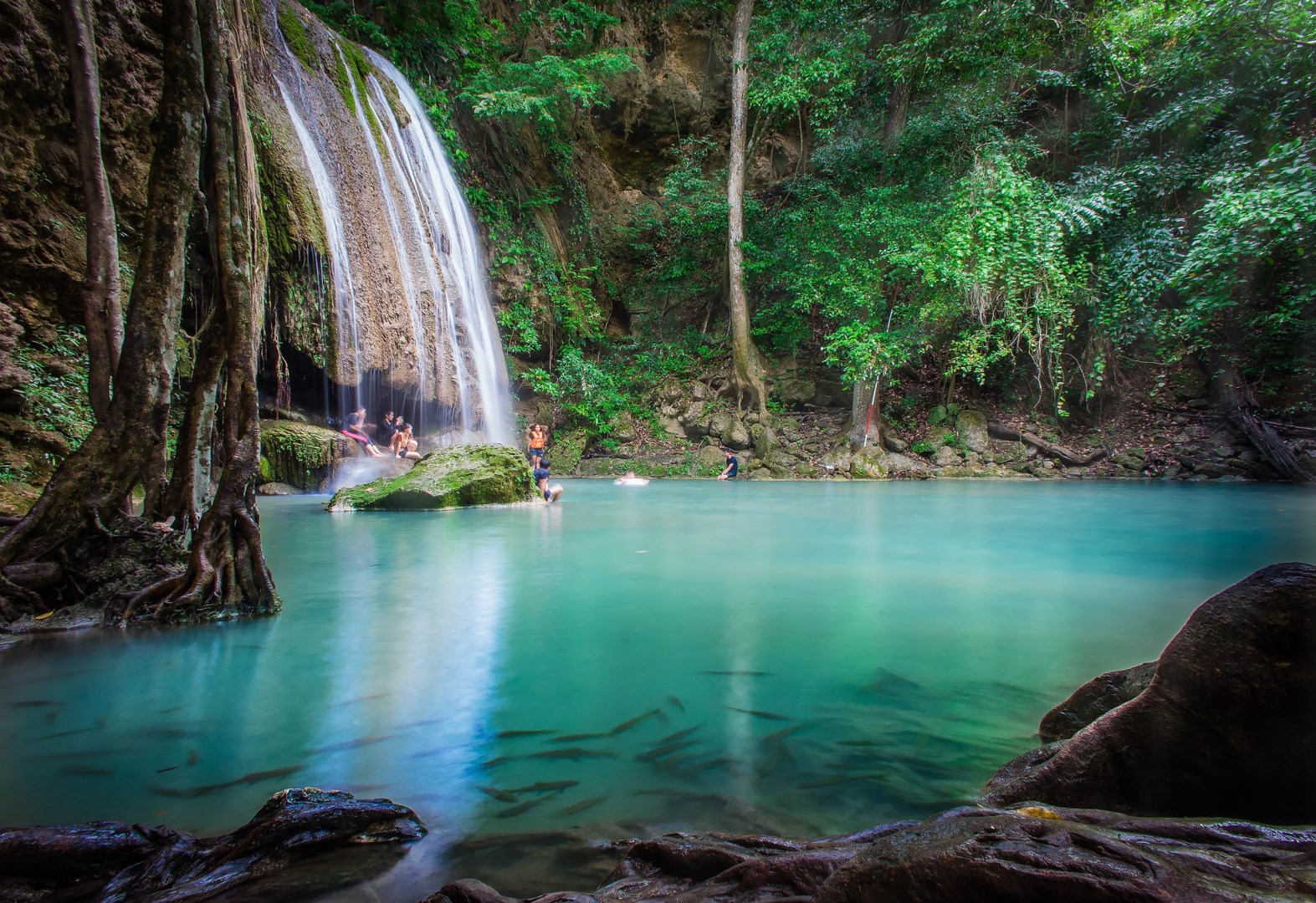
Erawan National Park is located in Kanchanaburi Province in western Thailand and is best known for its tiered waterfalls, limestone hills, and dense forest. The park covers a large area of mixed deciduous and evergreen woodland near the Tenasserim Hills close to the border with Myanmar.

Monteverde
Monteverde, located in the Tilarán Mountains of northwestern Costa Rica, is known for its cloud forests, winding trails, and biodiversity that has drawn researchers and travelers for decades. The area was settled in the 1950s by Quakers from the United States who were looking for a peaceful place to raise dairy cattle. They also played a major role in preserving the local ecosystem, helping to establish the Monteverde Cloud Forest Reserve in 1972.

Durham
Seen from the train, Durham presents a magnificent sight, with cathedral and castle perched atop a bluff enclosed by a loop of the River Wera, and linked to the suburbs by a series of sturdy bridges.
Abu Simbel
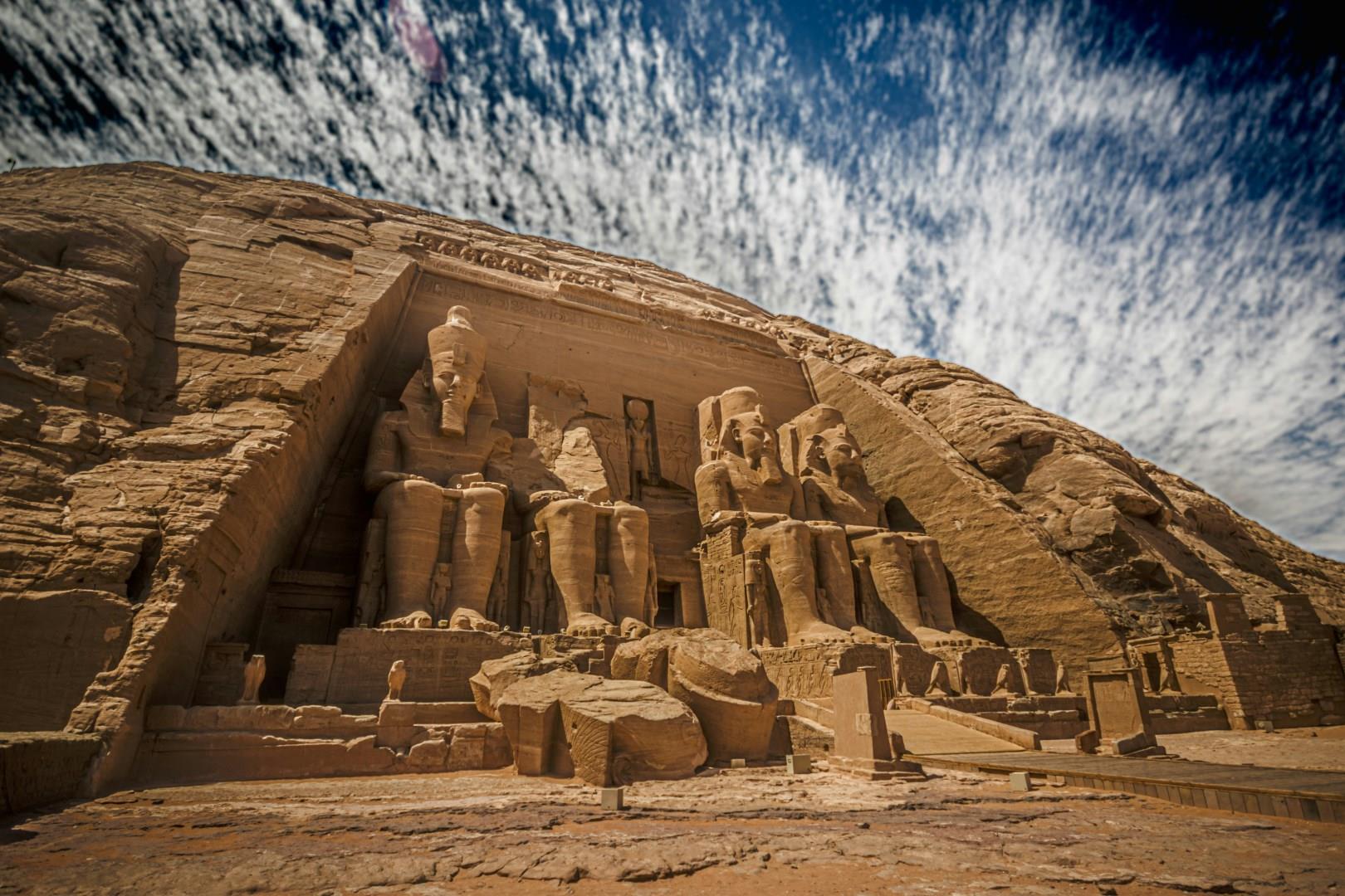
Abu Simbel, in southern Egypt near the border with Sudan, is one of the most awe-inspiring archaeological sites of the ancient world. Built during the reign of Pharaoh Ramses II in the 13th century BCE, the twin temples were carved directly into the sandstone cliffs overlooking the Nile. The Great Temple, with its four colossal statues of Ramses II seated at the entrance, was designed not only to honor the pharaoh but also to project his power to neighboring Nubia.