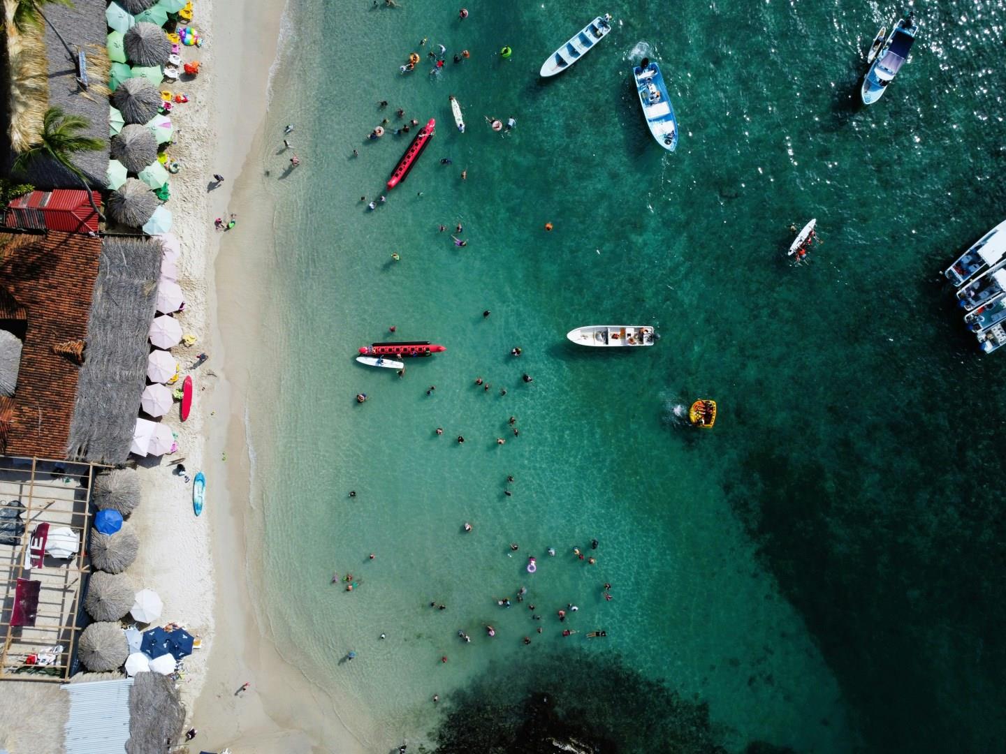
Zihuatanejo
Zihuatanejo, a charming coastal town on Mexico’s Pacific coast, invites travelers with its blend of serene beaches and vibrant local culture. Nestled on the Bay of Zihuatanejo, the town offers a picturesque escape with its stunning shoreline, where the gentle waves lap against golden sands. The tranquil atmosphere of Playa La Ropa, one of the town’s most renowned beaches, is perfect for sunbathing, swimming, and savoring fresh seafood from beachfront restaurants.
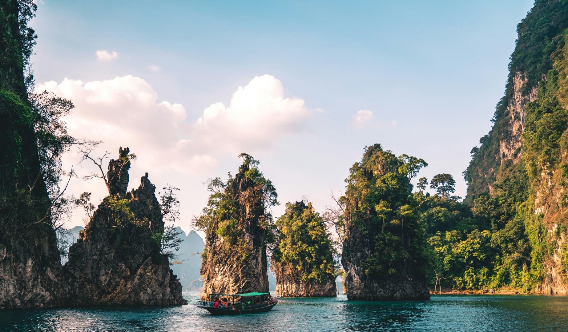
Khao Sok National Park
Khao Sok National Park in Thailand is a stunning natural haven that promises a truly immersive experience for nature lovers and adventure seekers. Nestled in southern Thailand, this sprawling park is renowned for its lush rainforests, dramatic limestone cliffs, and tranquil lakes. The park’s centerpiece, Cheow Lan Lake, is a breathtaking expanse of emerald waters surrounded by towering karst formations, ideal for boat tours and exploring floating lodges.
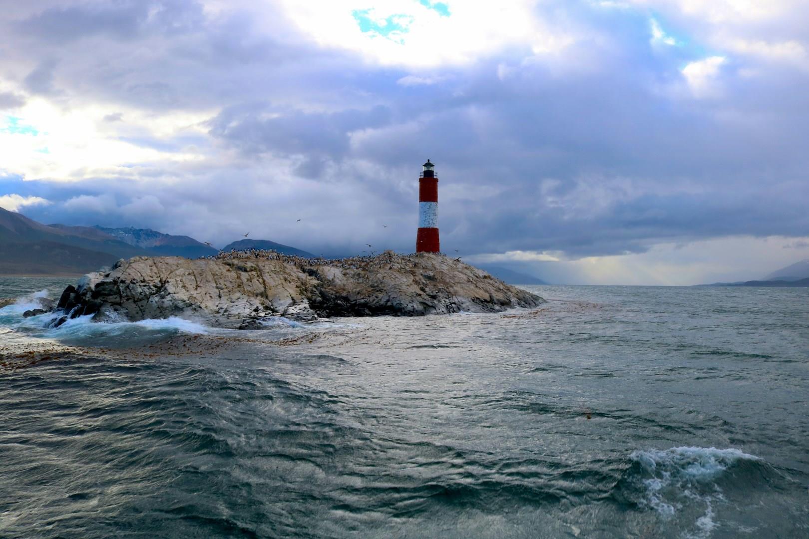
The Beagle Channel
The Beagle Channel, at the southern tip of South America, stretches between Chile and Argentina and offers one of the most striking maritime landscapes in the world. This narrow passage, framed by snow-covered peaks and rocky islands, connects the Atlantic and Pacific Oceans. Its waters are calm compared to the open sea, which has made it a historic navigation route for explorers and sailors for centuries.

Taormina
Taormina, with its hilltop location above the Ionian Sea, is easily one of Italy's most beautiful places. As it's packed with people in the summertime, recommended months to visit include April and September.
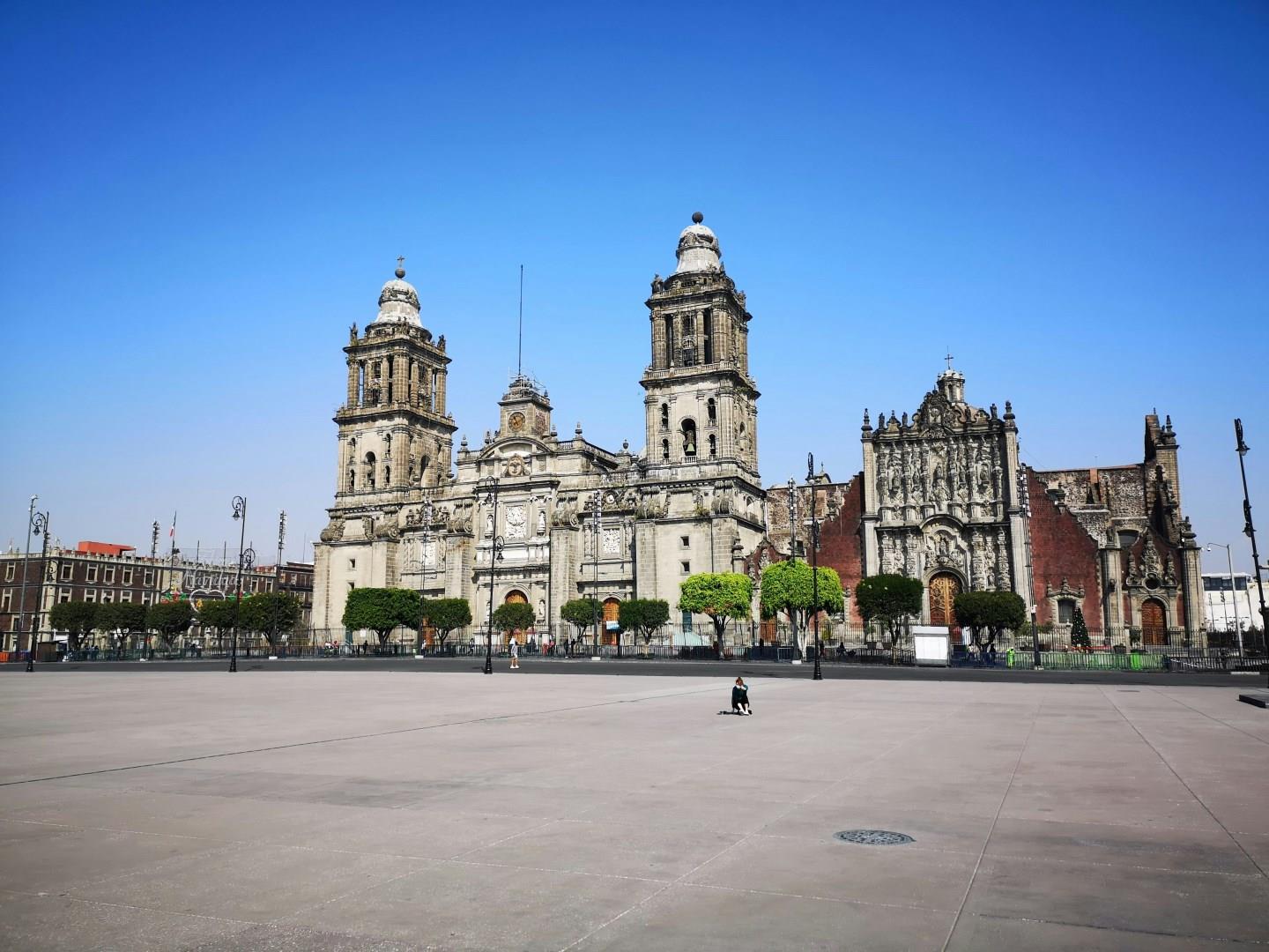
Mexico City
Mexico City sits on the high plateau of central Mexico, layered with more than seven centuries of history and culture. Built atop the ruins of the Aztec capital Tenochtitlán, the city reflects a continuous dialogue between Indigenous foundations, Spanish colonial influence, and modern urban life.