Alghero Sardinia
Alghero, located on the northwest coast of Sardinia, Italy, is a seaside city that blends history, culture, and natural beauty. Known as “Little Barcelona” due to its Catalan influence, Alghero’s old town is a maze of narrow cobblestone streets, colorful buildings, and medieval walls overlooking the Mediterranean Sea. Visitors can explore landmarks like the imposing Torre del Portal, a medieval tower that is a testament to the city’s rich heritage.
Pitlochry
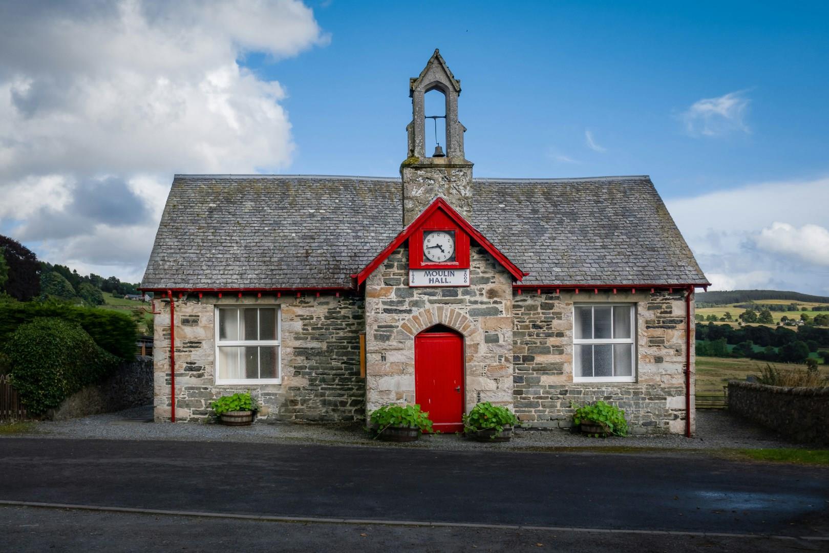
Pitlochry, a charming town in the heart of the Scottish Highlands, is celebrated for its Victorian architecture, scenic surroundings, and welcoming atmosphere.
Montagu
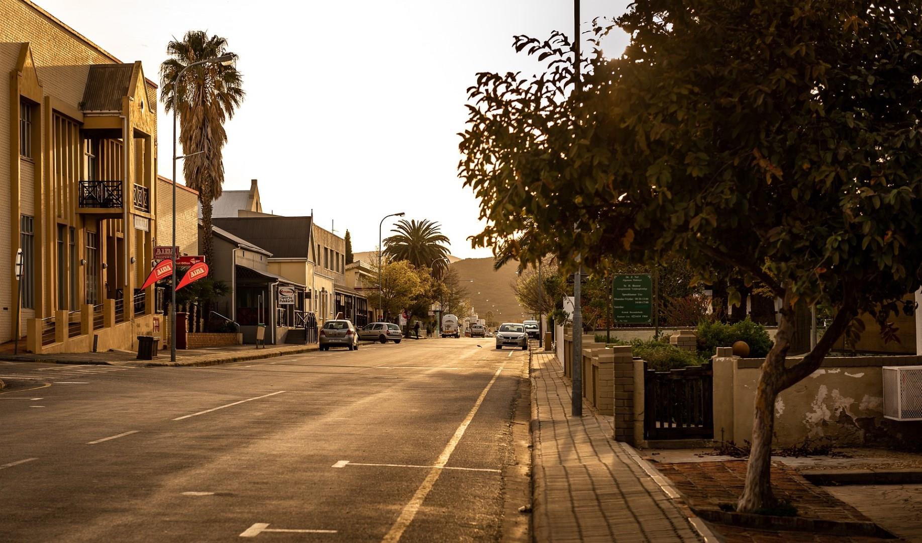
Nestled in the heart of South Africa’s Western Cape, Montagu is a charming town renowned for its natural beauty and historical significance. Surrounded by rugged mountains and lush vineyards, Montagu is a gateway to the stunning Klein Karoo region. Visitors are drawn to its remarkable architecture, particularly the well-preserved Cape Dutch and Victorian buildings that line the streets, reflecting the town’s rich history.
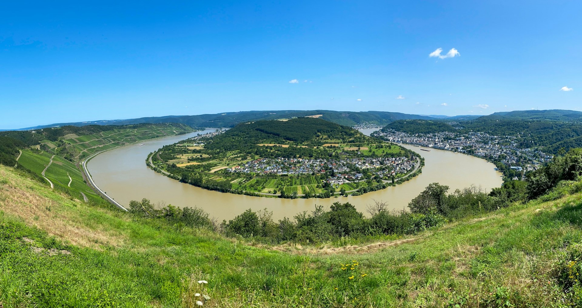
Boppard
Boppard, the pearl of the Rhein, gets its nickname from the fact that it is situated on part of a horse-shoe ben in the Rhein, resembling a pearl in an oyster shell. This bend is one of the most severe anywhere on the Rhein, so much so that the town frontage faces due north while the vineyards, one the same band face due south. The bend is also known as the "bendiest bend on the Rhein."

Kerala
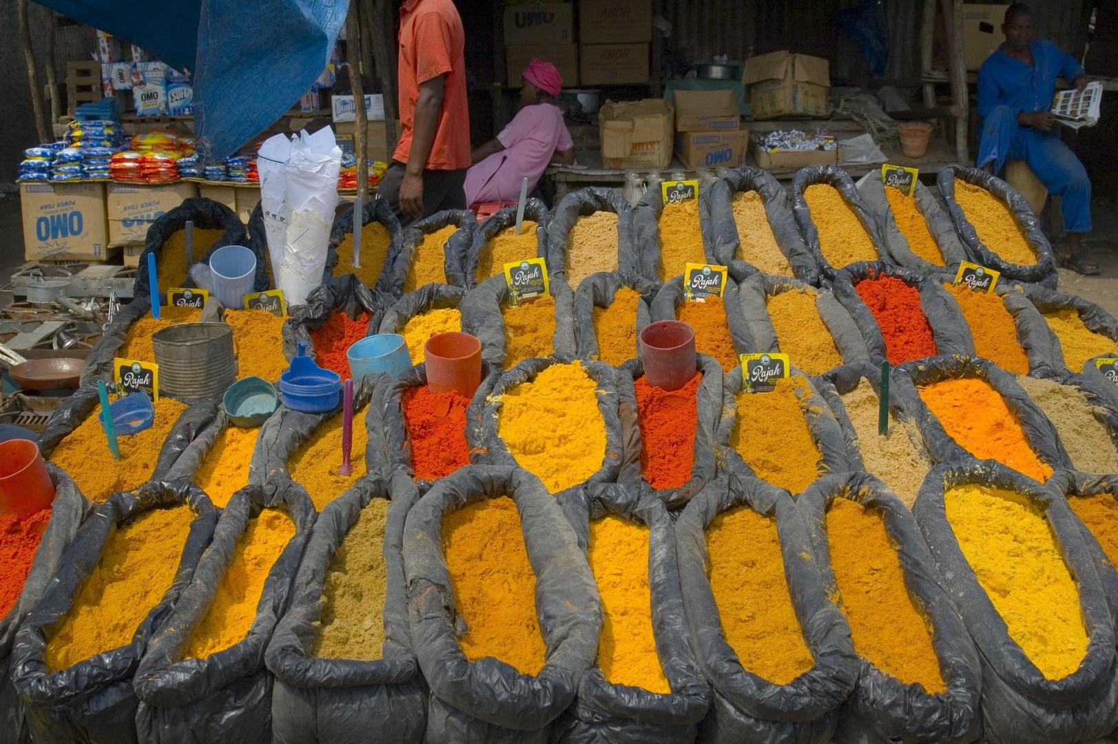
Kerala, India is a lush, tropical paradise that captivates travelers with its serene backwaters, vibrant culture, and stunning landscapes. Nestled between the Arabian Sea and the Western Ghats, Kerala boasts a unique blend of natural beauty and cultural richness. The tranquil backwaters of Alleppey and Kumarakom offer a quintessential Kerala experience, where visitors can cruise on traditional houseboats through a labyrinth of canals, lagoons, and lakes.