

Hallstatt
Nestled between the serene waters of Lake Hallstatt and the towering Dachstein mountains, Hallstatt, Austria, is a picturesque gem that seems almost too perfect to be real. This UNESCO World Heritage site is renowned for its stunning alpine scenery and charming architecture. Wander through the narrow streets lined with 16th-century houses and experience the timeless beauty that has captivated visitors for centuries.

Belfast
Belfast, the vibrant capital of Northern Ireland, is a city steeped in rich history and brimming with cultural charm. Known for its role in the Industrial Revolution, it was once a major shipbuilding hub, most famously the birthplace of the RMS Titanic. Today, visitors can explore the Titanic Quarter, where the Titanic Belfast museum stands as a modern architectural marvel, offering a fascinating and interactive journey through the ship's history.
Nassau
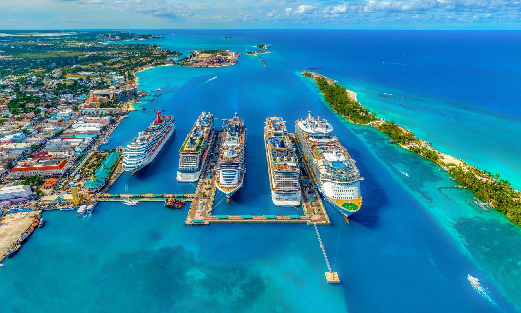
Beloved by cruise-goers, Nassau is a stunning Bahamian paradise and an essential destination on many Caribbean cruises. With so much to experience and explore, charming Nassau will easily enchant you on your adventure to the Bahamas! Hit one of Nassau’s many beaches, including Montagu Beach, Goodman’s Bay, and Cable Beach, to soak up some sunshine and relax in warm sands. Take a plunge in the ocean to snorkel or swim with dolphins, sharks, and sting rays.

Waikiki, Oahu
Waikiki, located on the island of Oahu, is a world-renowned destination that perfectly captures the spirit of Hawaii. Known for its iconic crescent-shaped beach, warm turquoise waters, and vibrant nightlife, Waikiki is where Hawaiian royalty once surfed and relaxed, and it remains a hotspot for both relaxation and adventure today.

Kigali
Kigali, the capital of Rwanda, is a city that blends modern energy with deep cultural roots. Set among rolling hills, it offers striking views at nearly every turn.


