
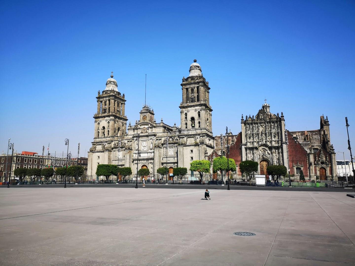
Mexico City
Mexico City sits on the high plateau of central Mexico, layered with more than seven centuries of history and culture. Built atop the ruins of the Aztec capital Tenochtitlán, the city reflects a continuous dialogue between Indigenous foundations, Spanish colonial influence, and modern urban life.
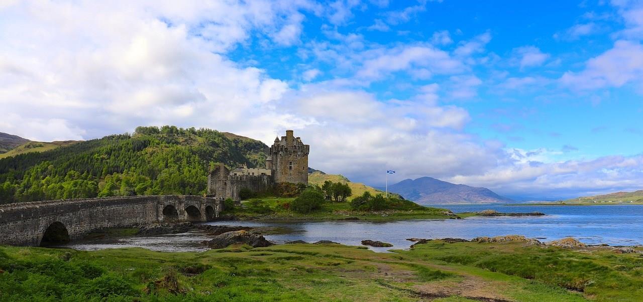
Kyle of Lochalsh
Kyle of Lochalsh, located on the west coast of the Scottish Highlands, serves as a gateway to the Isle of Skye via the Skye Bridge, but the village itself deserves more than a passing glance. Once the terminus of the Highland Railway, the town still welcomes visitors by train on one of the UK’s most scenic routes. The line from Inverness to Kyle passes through remote glens, past lochs and mountain ranges, ending just steps from the waterfront.
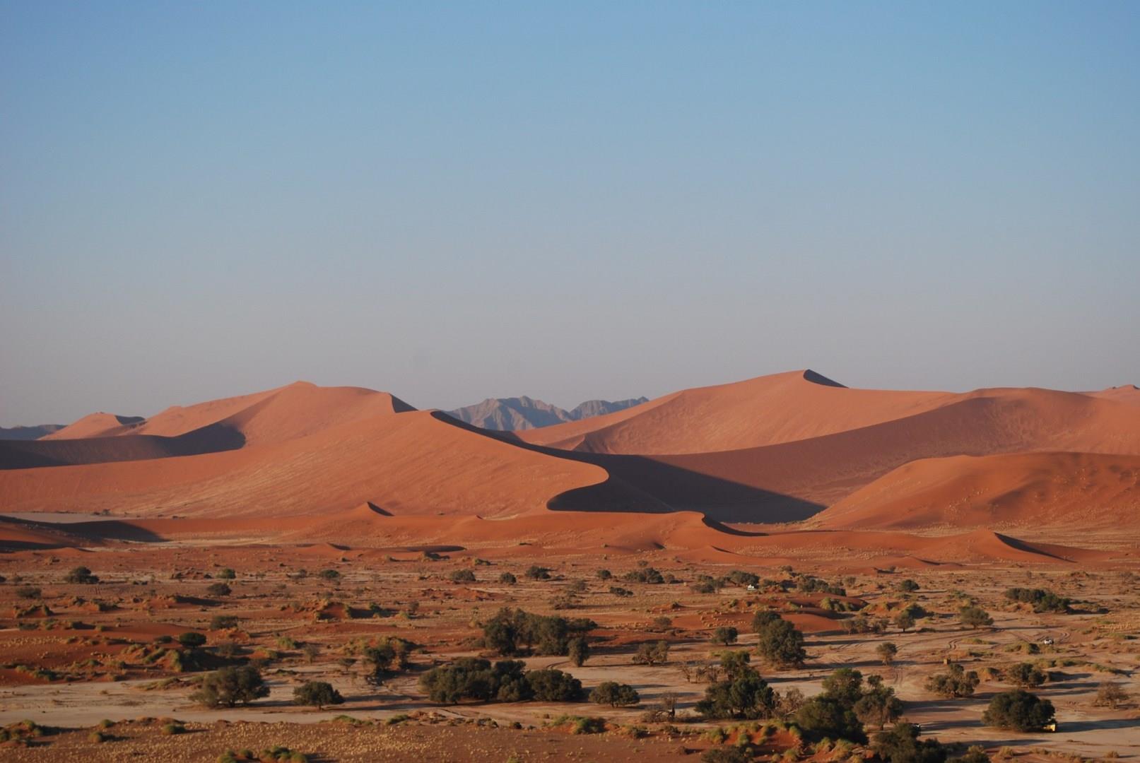
Sesriem
Sesriem, located in the heart of Namibia’s Namib Desert, serves as the gateway to the world-famous Sossusvlei and Deadvlei, two of Namibia’s most iconic landscapes. The dramatic red dunes of the Namib Desert, some of the highest in the world, are an awe-inspiring sight, particularly at sunrise when the light casts long shadows, creating an otherworldly contrast of colors.
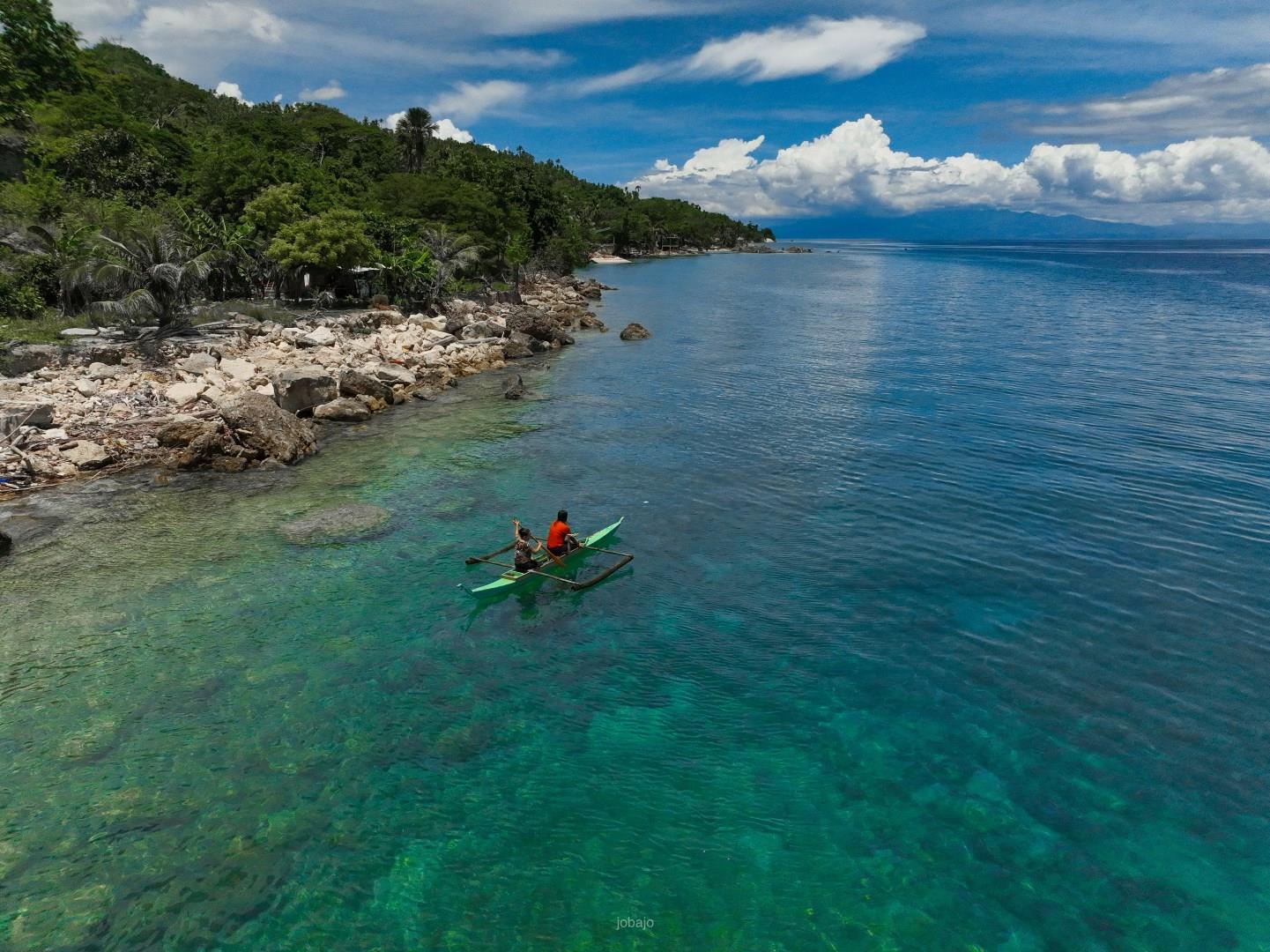
Cebu
Cebu sits at the center of the central Philippines, shaped by seafaring trade and early colonial contact. It was here that Spanish rule first took hold in the 16th century, leaving a legacy visible in churches, street patterns, and long-standing ties to Catholic tradition.

Abidjan
Abidjan, the largest city in Ivory Coast, is a vibrant coastal hub known for its striking skyline, lively markets, and cultural energy. Situated along the Ébrié Lagoon, it serves as the country’s economic and commercial center, blending modern urban life with West African traditions. Nicknamed the “Paris of West Africa,” Abidjan offers a dynamic mix of business districts, beachside neighborhoods, and green spaces that reflect its diverse character.


