Ghana, country in western Africa, bounded on the north and northwest by Burkina Faso, on the east by Togo, on the south by the Atlantic Ocean, and on the west by Côte d'Ivoire.
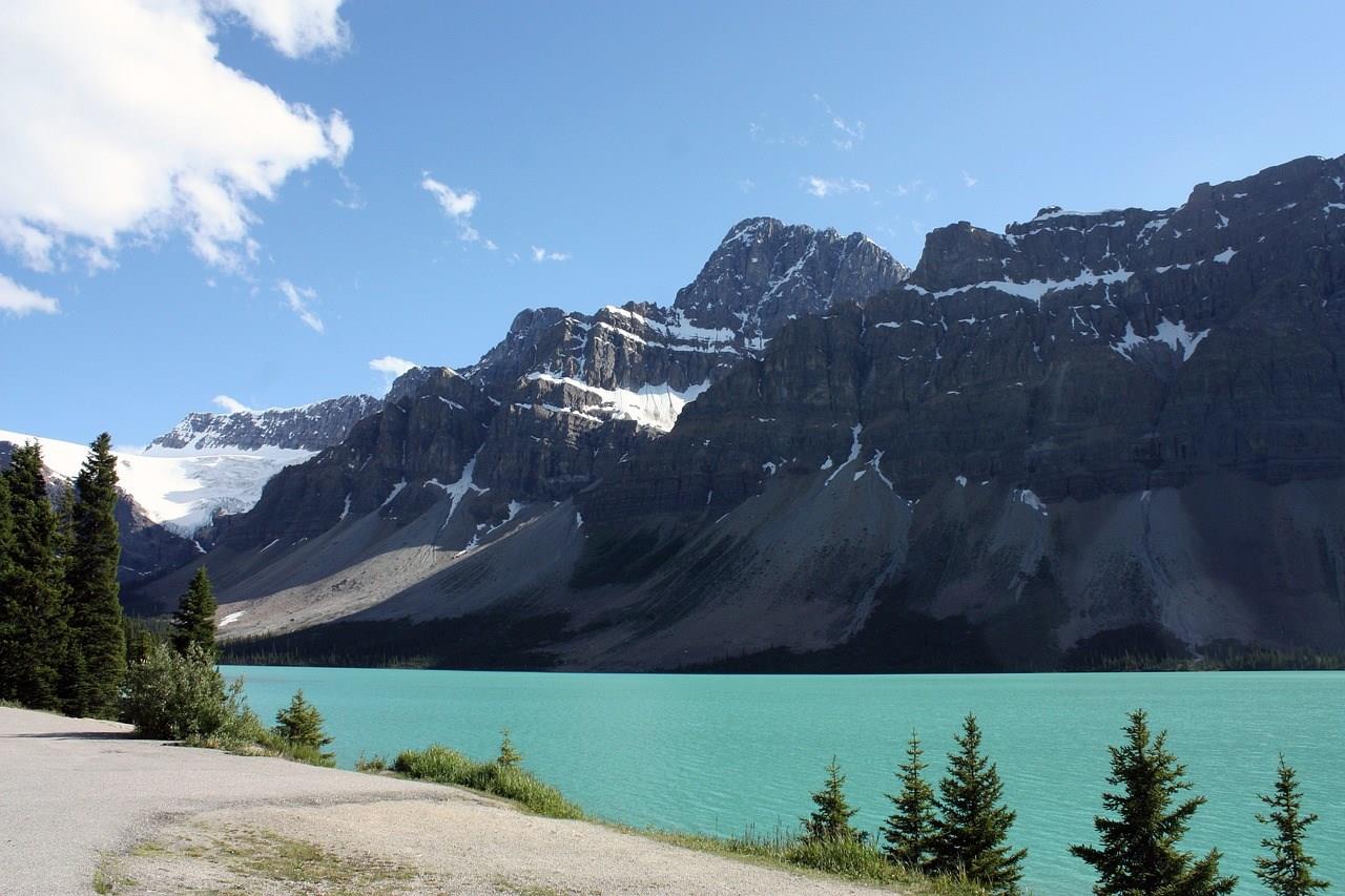
Jasper National Park, located in the heart of the Canadian Rockies in Alberta, is a breathtaking destination known for its stunning natural beauty and diverse wildlife. Spanning over 11,000 square kilometers, it is the largest national park in the Canadian Rockies and offers a wide range of outdoor activities such as hiking, camping, and wildlife viewing.
Sibenik's unique charm lies in its ability to offer both cultural depth and natural beauty, making it ideal for those seeking an authentic Croatian experience.
Spitsbergen is the largest island of Norway’s Svalbard archipelago, where the wonders of the Arctic come alive in breathtaking fashion. Known for its wild, untamed beauty, Spitsbergen offers travelers the chance to experience landscapes that are both surreal and majestic. From towering glaciers and jagged mountain peaks to expansive tundra and crystal-clear fjords, this frozen paradise is an explorer’s dream.
Tunis' white-washed, blue-shuttered buildings hide a treasure trove of Arabic and Ottoman art. Inspect illuminated manuscripts from the Koran, follow the twists and turns of the fascinating old Medina (inner city), marvel at the ornate Palace of Dar Ben Abduallah and the magnificent Djamaa-Ez-Zitouna Mosque, whose 184 columns were "recycled" from the rocky ruins of Carthage.
Mozambique, republic in southeastern Africa, bounded on the north by Tanzania; on the east by the Mozambique Channel of the Indian Ocean; on the south and southwest by South Africa and Swaziland; and on the west by Zimbabwe, Zambia, and Malawi. Mozambique gained independence from Portugal in 1975. It has a total area of 799,380 sq. km (308,641 sq. mi). Maputo is the capital and largest city.
The country has a 2470-km (1535-mi) coastline on the Mozambique Channel and possesses several good natural harbors.
Two-fifths of Mozambique is occupied by coastal lowlands. Inland the land rises to the west in a series of low hills and plateaus to reach high points of 2436 m (7992 ft) on Mount Binga near the western border and 2419 m (7936 ft) in the Namuli Highlands in the north. To the northwest, forming the western edge of Africa's Great Rift Valley—here occupied by Lake Nyasa (Lake Malawi) and the Shire River—is the Angonia Plateau. Soils are generally infertile except along river valleys and in parts of the Angonia Plateau.
The country's many rivers flow from the highlands of the west to the Mozambique Channel in the east. Chief among these is the Zambezi River; its upper reaches form a lake behind Cabora Bassa Dam. Other major rivers include the Rovuma, which forms part of the Tanzania border, and the Save and Limpopo rivers. Lake Nyasa forms part of the Malawi border and drains south through the Shire River into the Zambezi River. Mozambique has a tropical savanna type of climate, with a dry season that lasts from April to October. July (winter) temperatures average 21° C (70° F) at Pemba in the north and 18° C (65° F) at Maputo in the south. January (summer) temperatures average about 27° C (80° F) along the coast and lower in upland areas. Average annual rainfall decreases from 1500 mm (about 60 in) in the north to 750 mm (about 30 in) in the south, although amounts can be irregular.