Once a big, bustling sea port for the Scottish wool trade and known as Kampvere, Veere is now a small village whose economy mainly relies on tourism. A major point of interest for visitors is the Campveerse Toren (Campvere Tower), built as part of the city defenses around 1500 and now serving as one of the oldest inns in the Netherlands
Steeped in history, Canterbury, England is a must-visit destination for lovers of medieval charm and religious significance. The centerpiece of this historic city is Canterbury Cathedral, a UNESCO World Heritage Site that has been a place of Christian worship since the 6th century. As the seat of the Archbishop of Canterbury, it is one of the most important religious buildings in England.
Dar es Salaam, Tanzania’s largest city and economic hub, offers visitors a vibrant mix of African, Arab, and European influences, making it one of East Africa’s most culturally diverse cities. With its bustling markets, lively waterfront, and historical sites, Dar es Salaam gives tourists a glimpse into the country’s rich history and dynamic present.
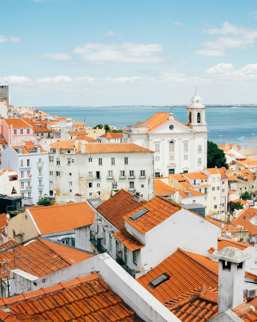
Portugal is a coastal country on the western side of Spain. It has many lovely beaches, golf courses and casinos. In the larger cities you can experience rich and varied nightlife, historical sites, and bullfighting.
Mozambique, republic in southeastern Africa, bounded on the north by Tanzania; on the east by the Mozambique Channel of the Indian Ocean; on the south and southwest by South Africa and Swaziland; and on the west by Zimbabwe, Zambia, and Malawi. Mozambique gained independence from Portugal in 1975. It has a total area of 799,380 sq. km (308,641 sq. mi). Maputo is the capital and largest city.
The country has a 2470-km (1535-mi) coastline on the Mozambique Channel and possesses several good natural harbors.
Two-fifths of Mozambique is occupied by coastal lowlands. Inland the land rises to the west in a series of low hills and plateaus to reach high points of 2436 m (7992 ft) on Mount Binga near the western border and 2419 m (7936 ft) in the Namuli Highlands in the north. To the northwest, forming the western edge of Africa's Great Rift Valley—here occupied by Lake Nyasa (Lake Malawi) and the Shire River—is the Angonia Plateau. Soils are generally infertile except along river valleys and in parts of the Angonia Plateau.
The country's many rivers flow from the highlands of the west to the Mozambique Channel in the east. Chief among these is the Zambezi River; its upper reaches form a lake behind Cabora Bassa Dam. Other major rivers include the Rovuma, which forms part of the Tanzania border, and the Save and Limpopo rivers. Lake Nyasa forms part of the Malawi border and drains south through the Shire River into the Zambezi River. Mozambique has a tropical savanna type of climate, with a dry season that lasts from April to October. July (winter) temperatures average 21° C (70° F) at Pemba in the north and 18° C (65° F) at Maputo in the south. January (summer) temperatures average about 27° C (80° F) along the coast and lower in upland areas. Average annual rainfall decreases from 1500 mm (about 60 in) in the north to 750 mm (about 30 in) in the south, although amounts can be irregular.